
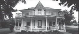
In the 2024 Cheese Festival Parade, look for T.B. and Elva Ferguson going down the road. Mrs. Elva Ferguson, in her book, “They Carried the Torch: The Story of Oklahoma’s Pioneer Newspapers”, mentions that in addition to telephone service (Oct. 2 issue of this newspaper) and electrification of towns and rural area (Sept. 25), attention was being turned to improved roads.
While there was a well-known military path between Ft. Reno and Ft. Supply along the North Canadian River in the 1880s (note that a cavalry rest station from this river is located behind the Ferguson Museum), few other roads existed until the land was surveyed and section lines were determined in preparation for the 1892 land run into Cheyenne-Arapaho area. With statehood, county commissioners were responsible for maintaining these section line roads. Going from one place to another might require multiple zigzags.
Due in part to a nationwide goodroads movement, an Oklahoma state Highway Department was created in 1907 and began to function in 1911. Unfortunately, it had neither an appropriation nor a construction-maintenance mandate (Encyclopedia of OK History and Culture) . “As the Automobile Age progressed, the number of cars and trucks in the state grew from 15,000 in 1914 to 127,000 in 1918 to 500,000 in 1926. The activity of good-roads promoters, chambers of commerce, and legions of automobile owners ensured the development of intrastate and interstate thoroughfares.”
The U.S. Congress Federal Aid Road Act of 1916 provided one-to-one matching grants to states for roadways, bridges, and structures on eligible state highways in a nascent Oklahoma Federal Aid System. By 1919 Oklahoma's legislature had appropriated funds to secure the federal match and funded it with a onecents gas tax (increased to 2.5 cents in 1924.)
State Highway 3 passed just south of Blaine County. The 1919 Oklahoma State highway map shows highway 8 traversing from Enid through Okeene, Watonga, Greenfield and Geary ODOT maps. The 1925 map shows an intermediate road under construction from 8 south of Geary crossing the South Canadian River to meet up with State HW 3 and US 66. By 1929 it was in operation over a toll bridge. The 3,900foot long William H. Murray Bridge was built in 1933, and contains 38 camelback pony truss spans. ODOT. The 1927 OK Highway map shows a proposed State highway 33 from Kingfisher through Watonga, Canton and Seiling. State Highways 8 and 33 and U.S. Highway 270 passing through Watonga form the backbone of major roads in Blaine County even today. https://www.okhistory.org/